


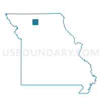
Madison Voting District, Grundy County, Missouri
About
Outline

Summary
| Unique Area Identifier | 607988 |
| Name | Madison Voting District |
| County | Grundy County |
| State | Missouri |
| Area (square miles) | 34.93 |
| Land Area (square miles) | 34.76 |
| Water Area (square miles) | 0.17 |
| % of Land Area | 99.52 |
| % of Water Area | 0.48 |
| Latitude of the Internal Point | 40.06036080 |
| Longtitude of the Internal Point | -93.70882610 |
Maps


Graphs
Select a template below for downloading or customizing gragh for Madison Voting District, Grundy County, Missouri


Neighbors
Neighoring Voting District (by Name) Neighboring Voting District on the Map
- Boyd Voting District, Daviess County, MO
- Harrison Voting District, Grundy County, MO
- Jamesport Voting District, Daviess County, MO
- Jefferson Voting District, Grundy County, MO
- Taylor Voting District, Grundy County, MO
- Trenton Ward 1, Grundy County, MO
- Trenton Ward 2, Grundy County, MO
Top 10 Neighboring County Subdivision (by Population) Neighboring County Subdivision on the Map
- Trenton township, Grundy County, MO (6,393)
- Jamesport township, Daviess County, MO (1,085)
- Madison township, Grundy County, MO (626)
- Jefferson township, Grundy County, MO (445)
- Taylor township, Grundy County, MO (179)
- Harrison township, Grundy County, MO (108)
- Lincoln township, Daviess County, MO (108)
Top 10 Neighboring Place (by Population) Neighboring Place on the Map
Top 10 Neighboring Unified School District (by Population) Neighboring Unified School District on the Map
- Trenton R-IX School District, MO (7,824)
- Tri-County R-VII School District, MO (2,010)
- Gilman City R-IV School District, MO (785)